Overview
This is a memo about updates made to the IIIF georeference extension visualization tool.
The tool is published at the following location.
https://github.com/nakamura196/iiif_geo
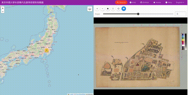
It provides a side-by-side display of modern maps and images, as shown below.
Update Details
Allmaps is a tool that supports data creation based on the IIIF georeference extension.
Its usage is introduced in the following article.
In this update, support was added to load data created by the above tool.
https://annotations.allmaps.org/images/2e1d3f991aad6cb4
Below is an example display.
https://nakamura196.github.io/iiif_geo/ja?u=https://annotations.allmaps.org/images/2e1d3f991aad6cb4
Summary
I hope this serves as a useful reference for applications of the IIIF georeference extension.