A tool for generating XYZ tiles from IIIF Georeference Extension JSON and displaying them with MapLibre GL JS.
Requirements#
- Python 3.x
- GDAL (
gdal_translate, gdalwarp, gdal2tiles.py)
Installing GDAL#
Usage#
Example#
Options#
| Option | Default | Description |
|---|
--scale | 0.25 | Image scale factor |
--zoom | 14-18 | Tile zoom level range |
--output-dir | docs | Output directory |
--name | tiles | Tile folder name |
--work-dir | work | Working directory |
--keep-work | - | Do not delete working files |
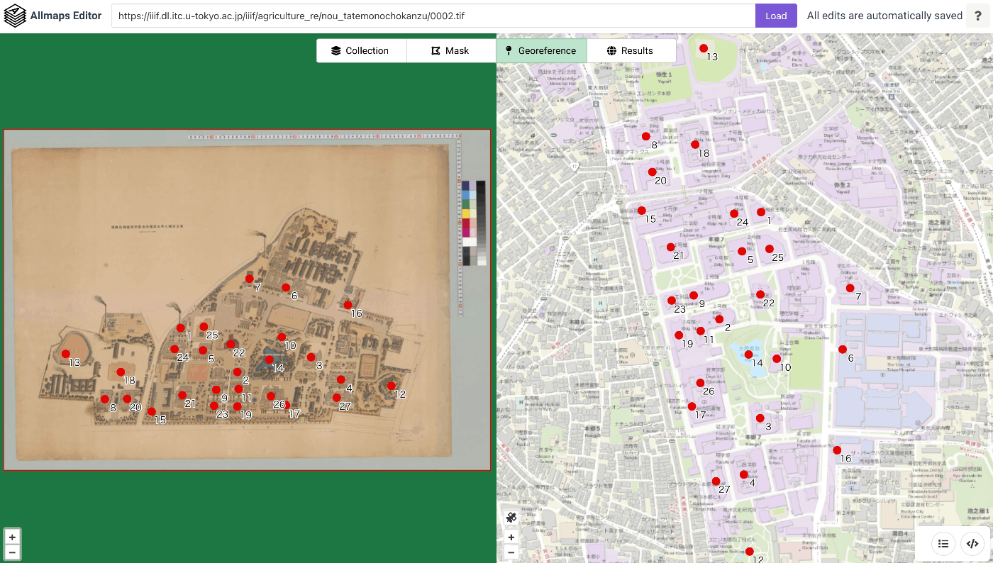
Processing Flow#
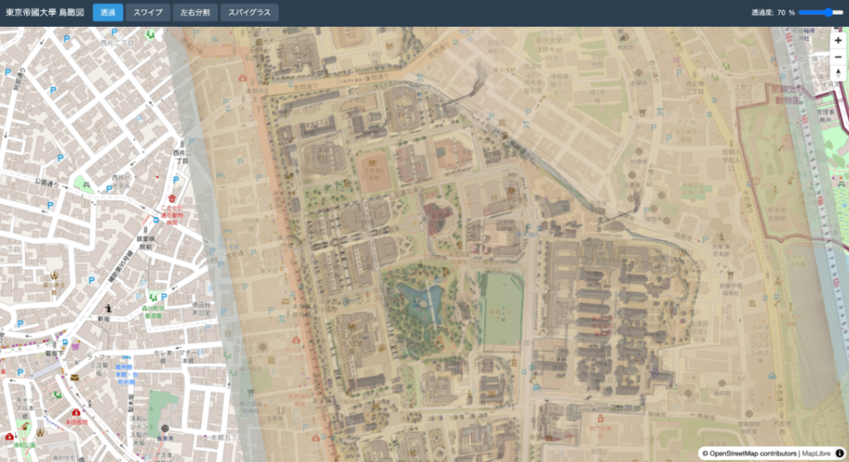
Conversion Results#
| Original image | After georeferencing |
|---|
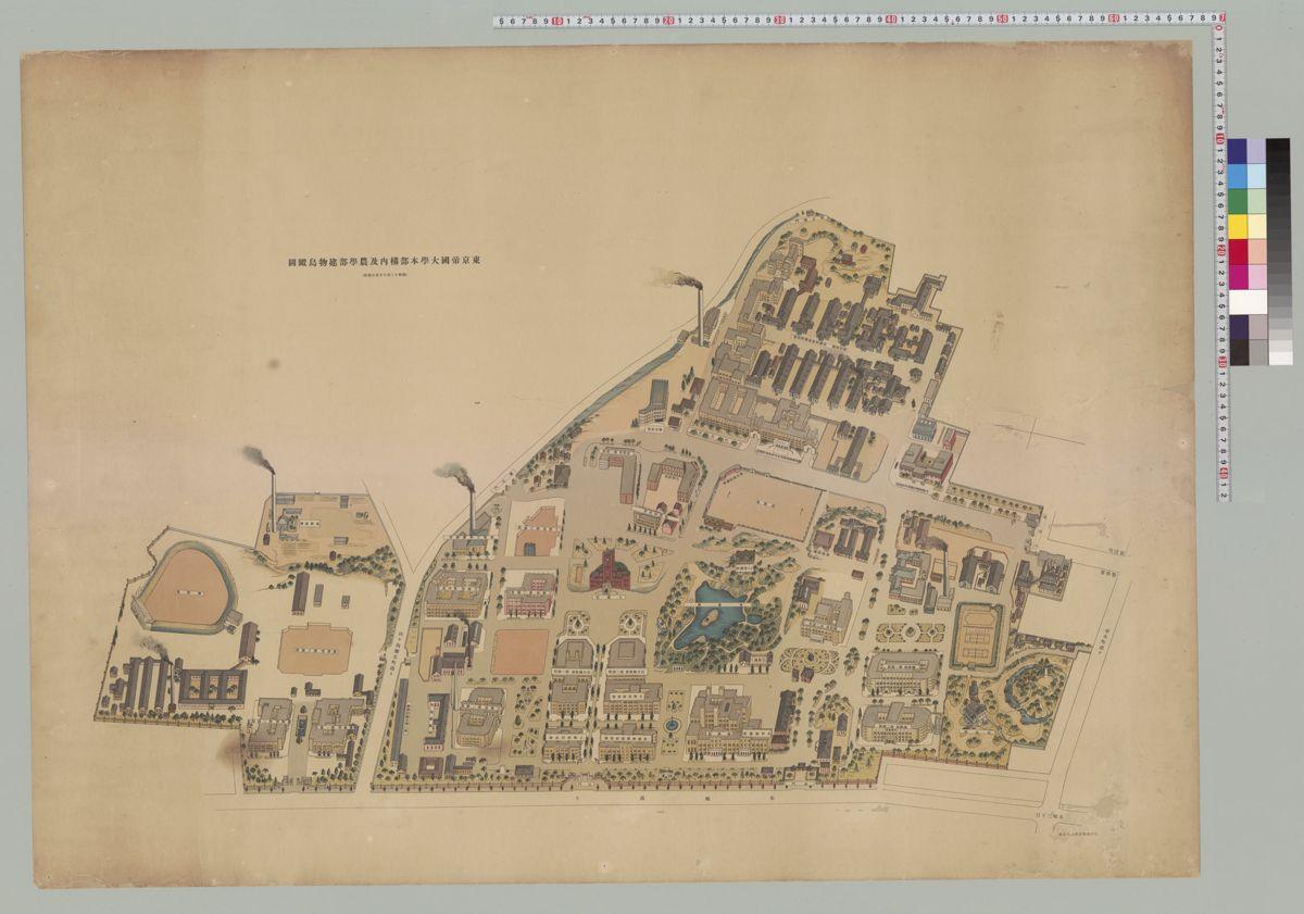 | 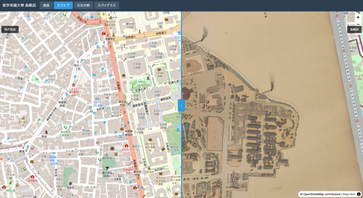 |
Output Files#
Local Preview#
IIIF Georeference Extension#
The IIIF Georeference Extension is an extension specification for adding georeference information to IIIF images.
JSON Structure#
Sample Data Source#
The image used in the demo is obtained from:
- Bird’s-eye View of the University of Tokyo Main Campus and Faculty of Agriculture Buildings
References#