IIIF Georeference Extension JSONからXYZタイルを生成し、MapLibre GL JSで表示するツール。
必要環境#
- Python 3.x
- GDAL (
gdal_translate, gdalwarp, gdal2tiles.py)
GDALのインストール#
使用方法#
オプション#
| オプション | デフォルト | 説明 |
|---|
--scale | 0.25 | 画像の縮小率 |
--zoom | 14-18 | タイルのズームレベル範囲 |
--output-dir | docs | 出力ディレクトリ |
--name | tiles | タイルフォルダ名 |
--work-dir | work | 作業用ディレクトリ |
--keep-work | - | 作業用ファイルを削除しない |
処理の流れ#
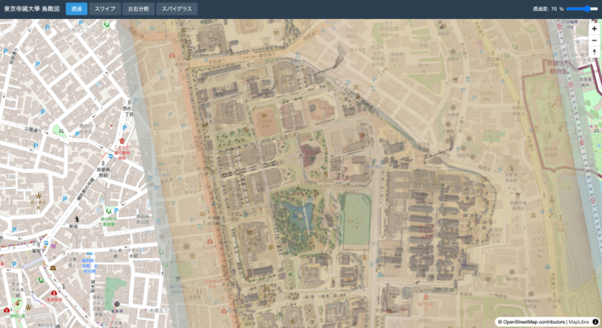
変換結果#
| 元画像 | 地理参照後 |
|---|
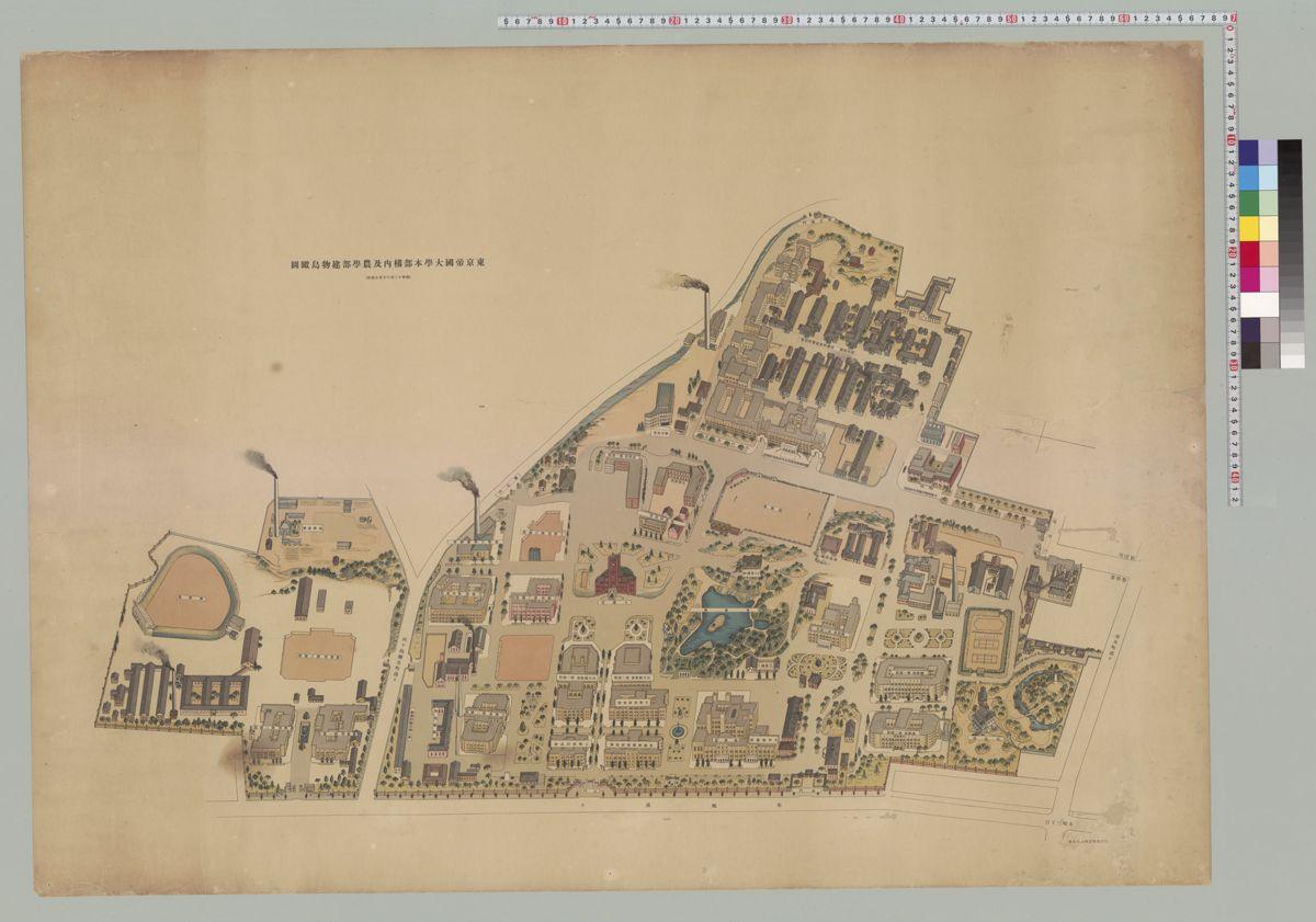 | 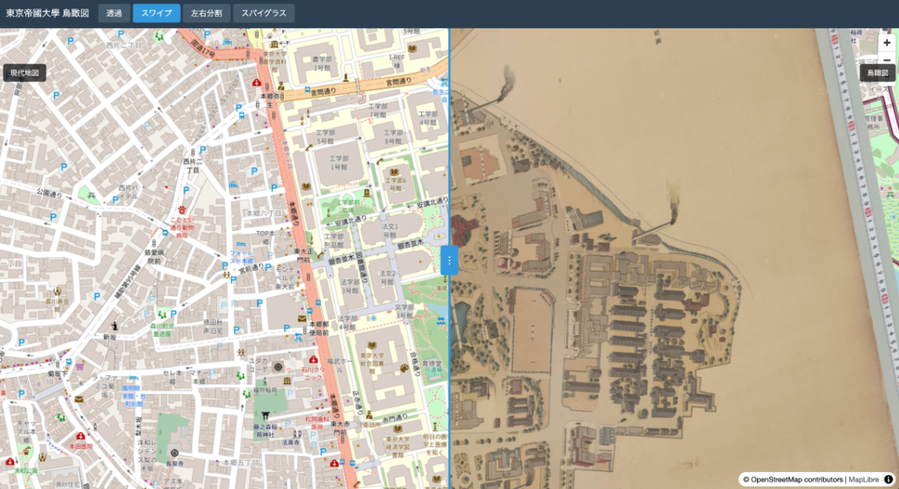 |
出力ファイル#
ローカルで確認#
IIIF Georeference Extension#
IIIF Georeference Extensionは、IIIF画像に地理参照情報を付与するための拡張仕様です。
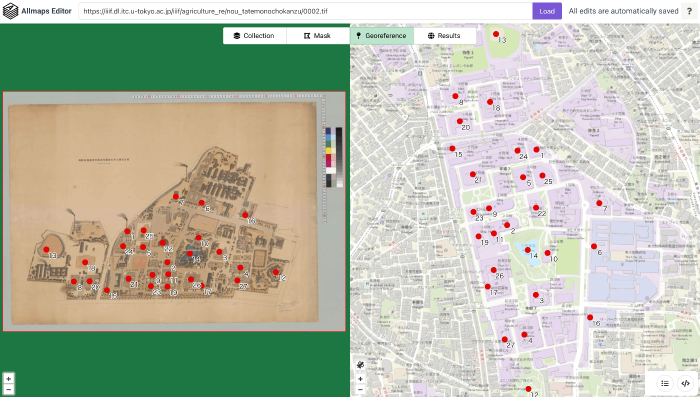
JSONの構造#
サンプルデータの出典#
デモで使用している画像は以下から取得しています: